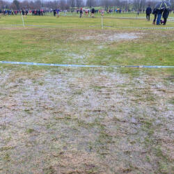
 Stirling Weather Information Past Week Sunday January, 5 to Saturday January, 11 The first working week of 2020 was wet and windy. A weekly rainfall total of 86.6mm was our highest weekly total since mid-March 2019 with over two inches of rainfall recorded on Friday evening and Saturday. Our maximum wind speed recorded was 47mph on Tuesday 7, our highest of 2020 so far. Despite a couple of mornings of frost it was in general a mild week with four days reaching double figures and the 12.9ºC recorded on Tuesday 7, is our highest temperature of the winter season. Maximum Temperature: 12.9ºC Tuesday January, 7 Lowest Temperature: -2.7ºC Friday January 10 Maximum Daily Rainfall: 37.3mm Saturday January, 11 Weekly Rainfall Total: 86.6mm Maximum Wind Gust: 47mph Tuesday January, 7 The Week Ahead Similar to last week this week also started off wet and windy with wind speeds around 45mph on Monday. It will remain blustery for most of the week. Wednesday could be a drier day but rain is expected to return on Thursday. Most of the wet weather this week is expected to fall as rain but at lower levels it could turn occasionally to sleet. There are signs that from Friday and into the weekend that more settled conditions will move into the area and with that temperatures would drop to freezing and below. Earliest Sunrise: 08:30 Latest Sunset: 16:23 Did You know: It’s been a wet past week and the longest period in January we have went without any rainfall was for 6 days during 2017. On January 26, 2016 we recorded our wettest January day with 43.8mm of rainfall with over 9mm falling in just one hour in a month that saw 231mm of rain. For the local weather news including historical and real-time weather information from Stirling visit www.stirlingweather.co.uk and on social media @stirlingweather and also our weather editor @scottlmclean Leave a Reply. |
Scott McLeanBusiness , Weather, Community, Charity Archives
May 2022
Categories
All
|


 RSS Feed

18/1/2020
0 Comments